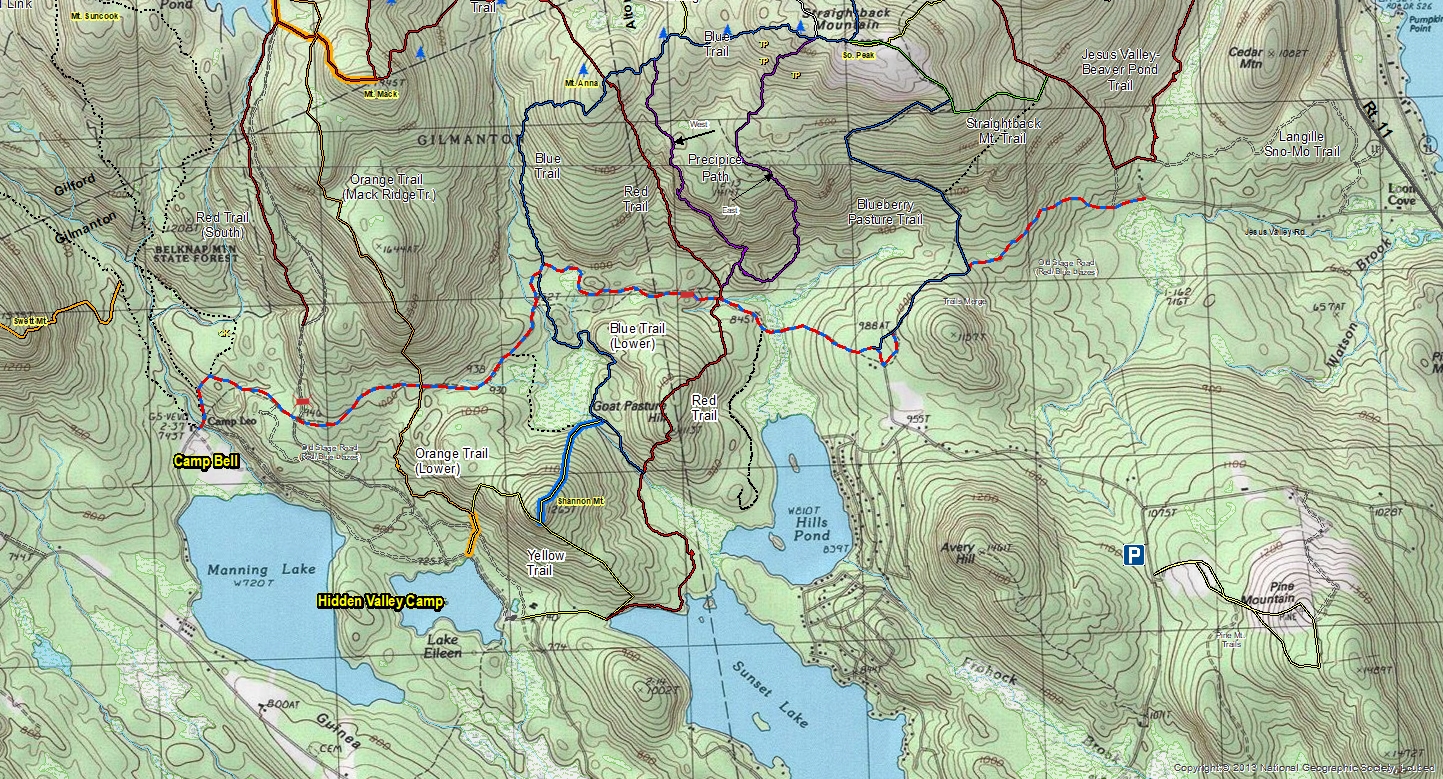
The Old Stage Road (blazed red/blue) through Griswold Scout Reservation has a complicated history. In colonial times the now Old Stage Road was an extension of the now Manning Lake Road and went east and ended at the farmstead, now a cellar hole, in the center of the Reservation, at what is called the logging camp outpost. On the east side of the property, Alton Mountain road extended northwest to the farmsteads on the eastern boundary of the property in the area where the red trail crosses the now Old Stage Road and ended there. So in the era of Stage Coaches, that road never went through. Around the 1940’s a logging company punched a rough road through what is now the Reservation to move their portable sawmill and connected the then abandoned portions of the two roads. That old road then became the red/blue trail for the boy scouts, but was flooded by beaver in one section east of West Brook and was quite wet in another section between that beaver swamp and the eastern boundary. In 1977, the Scouts built a road from the Hidden Valley camp to the eastern portion of the now Old Stage Road and made it passable to trucks easterly to West Brook. In the mid 1990’s, I set up a timber sale in the West Brook valley and along the red/blue trail. As part of that sale, the loggers built a new road easterly across West Brook and around the north side of the beaver swamp and by-passed the other wet spot and ended the road where the gate is now located. There was only a hiking trail between the gate and the eastern boundary. The Gilmanton snowmobile club soon discovered the improved road and widened the hiking trail at the end of the road to accommodate their groomer and to connect with the old Alton Mountain Road section. I have not been easterly beyond the old gravel pit on the east boundary of the Reservation for many years and do not know what has happened in that area of late. (I was able to drive a VW Rabbit to the red trail-Old Stage Road junction in 1995) If the Alton section was once a public road, it is still the legal Right-of-Way to the Reservation. I do not know when and if that section of Alton Mountain Road was abandoned, but I assume it was around the same time the farmsteads were abandoned. Research on the history of now abandoned section of Alton Mountain Road may uncover something of further interest.
The above information is provided by Ron Klemarczyk who is the forester for the Griswold Scout Reservation.
Dave Roberts original maps (circa 2010) labeled at least a part of this road/trail as “Old Stage Road”. When I began updating Dave Robert’s trail maps in 2013, I, as it appears now, incorrectly labeled the entire road/trail extending from Camp Bell to Jesus Valley Rd. as the “Old Stage Road.” Thus, is history modified. (W. Bosworth, 2019)