Click to download these trail descriptions.
Trail Name: Blue Trail
Gilford, NH
Trail Description: Southern New Hampshire Trail Guide. 3rd Edition. 2010. Compiled and Edited by Gene Daniell and Steven D. Smith. Appalachian Mountain Club Books. Boston, MA.
________________________________________________________________________________________
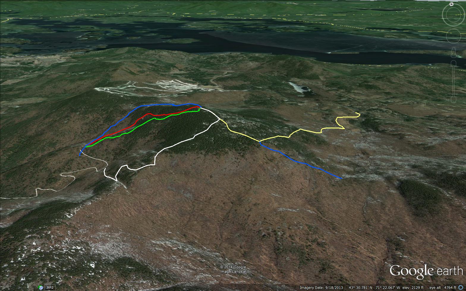
Blue Trail – Description
The Blue Trail (blazed blue) runs from the upper parking lot on Carriage Rd. to the summit of Belknap Mountain. It follows the extension of the Carriage Road past the garage and the junctions with the Red and Green trails, descends slightly to cross a brook, then diverges right and climbs to the Belknap-Gunstock col at 0.6 mi. Here the orange-blazed Overlook Trail continues straight and the white-blazed Saddle Trail begins. The Blue Trail, now coinciding with the Belknap Range Trail, turns right and climbs, crossing a meadow with a limited outlook to Gunstock Mtn. at 0.7 mi. and a restricted view north to the Sandwich Range at 0.8 mi., and continues up through coniferous woods to where it starts to level. There is a good view towards left of Lake Winnipesauke and Mt. Washington here. It hen continues to the summit. Descending, the Blue Trail starts by the northeast (Lake) side of the fire tower.
Distances from the upper Carriage Rd. parking lot:
- to Belknap-Gunstock col (2000 ft.): 0.6 mi. (1 km.), 350 ft., 30 min.
- to Belknap Mountain summit (2382 ft.): 1.1 mi. (1.8 km.), 700 ft., 55 min
Trail Name: Green (AKA Warden’s) Trail
Gilford, NH
Trail Description: Southern New Hampshire Trail Guide. 3rd Edition. 2010. Compiled and Edited by Gene Daniell and Steven D. Smith. Appalachian Mountain Club Books. Boston, MA.
__________________________________________________________________________________________
Green Trail – Description
The Green Trail (blazed green) runs from the upper parking lot on Carriage Rd. to the summit of Belknap Mountain. It is the shortest route to the summit of Belknap Mtn. but is rather steep with ledges that are slippery when wet, particularly when descending. It leaves the Carriage Road extension behind the garage and ascends on a service road, crossing a telephone line. It continues to climb, (with occasional switchbacks off the service road) passes a well (on the right, not dependable), and reaches the tower at the summit. Descending, the Green Trail begins on the southwest side of the fire tower.
Distances from the upper Carriage Rd. parking lot:
- to Belknap Mountain summit (2382 ft.): 0.8 mi. (1.3 km.),700 ft., 40 min.
Trail Name: Red Trail
Gilford, NH
Trail Description: Southern New Hampshire Trail Guide. 3rd Edition. 2010. Compiled and Edited by Gene Daniell and Steven D. Smith. Appalachian Mountain Club Books. Boston, MA. __________________________________________________________________________________________
Red Trail – Description
The Red Trail (blazed red) runs from the upper parking lot on Carriage Rd. to the summit of Belknap Mountain. This trail, less steep and more scenic than the Green Trail but somewhat rough in parts, climbs from the upper Carriage Road. parking lot to the summit of Belknap Mt. It leaves the Carriage Road extension just beyond the Green Trail junction, climbs past a good outlook to the west at 0.5 mi. and continues to the summit. As the trail turns right, where it becomes level, avoid the communications building straight ahead.
Distances from the Carriage Rd. parking lot:
- to Belknap Mountain summit (2382 ft.): (0.9 ) mi. (1.4 km.),700 ft., 40 min.