Description by Dave Roberts
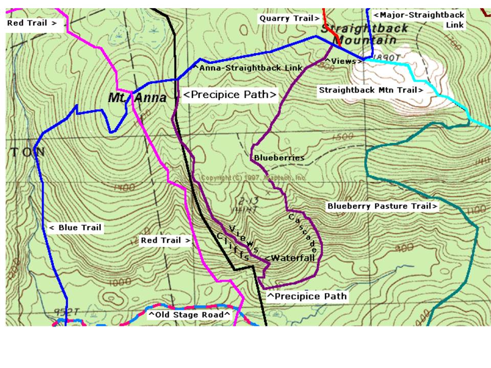
The Precipice Path, about 2.5 miles long, passes through varying, sometimes difficult terrain while exploring much of the southwest slope of Straightback Mountain. It includes a descent beside a steeply cascading stream, a visit to a waterfall, a cautious walk across the top of a several hundred yard long cliff face, and passage through several different forest types. Several brook crossings could be difficult in periods of very high water.
On the first leg, it descends to the base of the mountain, starting southerly down a ledgy, wooded slope, leveling off briefly while passing through an old blueberry lot, then following a fairly steep, cascading stream (when there is water) to the mountain’s base. Next it makes a westerly traverse of an old pasture site (now grown up to mature forest), then winds its way up a rise through a glacier-created boulder field, soon leading to the base of the Belknap Range’s finest waterfall, which tumbles over the southern edge of a long series of cliffs located at the western extreme of the mountain.
From there, it requires a scramble up a talus slope at the side of the waterfall and a short climb up the face of the cliff in preparation for a northerly traverse of several hundred yards across the top of the long series of cliffs. Frequent views from the cliff top to the south and west are quite nice. Great care must be taken here as these cliffs are up to 90 ft high, and the footing is not always good, especially when it’s wet.
Upon leaving the cliffs, the trail passes briefly through an old cutover, then winds through a mature forest to meet the trail between Mt Anna and Straightback Mountain. Going left from there will take you to Mt Anna, while going right will take you back to Straightback Mountain, from where you started.